
Russia Proposes Superhighway Linking New York And London
EUROPE TO U.S.A BY ROAD AND TRAIN THROUGH RUSSIA
Trans-Eurasian Belt Development (TEPR)
Trans-Eurasian Belt Development (TEPR)
EUROPE CAN BE CONNECTED BY ROAD AND RAILWAY THROUGH RUSSIA.
MAP SHOWS THE ROUTE FROM LONDON TO U.S.A BY PASSING THROUGH RUSSIA
THE MAP SHOWS THE ROUTE STARTING FROM ENGLAND IN LONDON TO GERMANY BERLIN , TO POLAND WARSAW AND REACHES THE EUROPEAN RUSSIA BY ROAD AND RAIL AT MOSCOW . THE MOTOR HIGHWAY PASSING THROUGH THESE PLACES CONNECT LONDON AND RUSSIA BY ROAD AND FOR RAILWAY AT MOSCOW
IN RUSSIA , THE EUROPEAN RUSSIA IN THE WEST AT MOSCOW IS CONNECTED TO PORT CITY IN THE EAST LIKE VLADMIR YAKUMIN , A SMALL CITY WITH LARGE RUSSIA NAVAL BASE IS CONNECTED BY ROAD AND RAILWAY . THE EUROPEAN ROAD AND RAILWAY EXTEND FROM RUSSIA AT MOSCOW TO VLADMIR YAKUMIN BY THE RUSSIA ROAD AND RUSSIA TRANS SIBERIAN RAILWAY
IN RUSSIA THE TRANS SIBERIAN RAILWAY WHICH THE LONGEST RAILWAY IN RUSSIA THAT DIVIDE RUSSIA IN TO TWO AS IT PASSES THROUGH THE MIDDLE OF RUSSIA FROM MOSCOW TO VLADMIR YAKUMIN CONNECTING FROM EUROPEAN RUSSIA IN THE WEST TO THE PORT CITY WHICH IS THE RUSSIA IMPORTANT NAVAL BASE IN TH EAST . THE TRANS SIBERIAN RAILWAY PASSES THOROUGH THE WORLD LARGEST SIBERIAN DESERT AND URAL MOUNTAIN CONNECTING EUROPEAN RUSSIA FROM WEST TO THE EAST . IN RUSSIA COAL ENERGY IS USED TO POWER THE ELECTRIC ENGINE OF THE TRAIN OPERATED BY RUSSIAN MILITARY LIKE K.G.B AND THE GOVERNMENT .
THIS RAILWAY IS THE LIFE LINE OF RUSSIA AS LOT OF PEOPLE MOVE FROM EAST TO WEST OF RUSSIA AND RETURN BY THIS RAILWAY .
FROM THE RUSSIA PORT CITY THE ROAD AND RAILWAY REACHES NOME CROSSES PACIFIC OCEAN AND CONNECT TO FAIR BANKS IN THE CANNADA TO U.S.A THAT CAN GO TO CALIFORNIA OR NEW YORK
THIS MAP IS PREPARED BY RUSSIA
What if U.S. citizens could drive...to Asia? A new proposal from Russia would see the country connected to the U.S. by highway bridge as part of a massive superhighway crossing the length of Russia, ultimately linking New York and London.
ALSO SEE: Lincoln Continental Concept Debuts At The 2015 New York Auto Show
Called the Trans-Eurasian Belt Development (TEPR). the ambitious project was proposed by Russian Railways head Vladimir Yakunin earlier this month, according to CNN.
The route would include some pre-existing roads to reach London and New York, but would still require thousands of miles of tarmac across the width of Russia. This would be laid alongside the existing Trans-Siberian Railway—the longest railway in the world.
Connecting the North American and Eurasian continents would also be complicated. The highway would have to span a minimum 55-mile distance between mainland Russia and Alaska, and continue on through the isolated state's wilderness. About 520 miles separates the closet settlement to Russia—Nome—from the nearest major city, Fairbanks. From there, drivers could connect to an existing road network to Canada and the Lower 48 states.
CNN estimates that a driver from London to New York via the TEPR would encompass 12,910 miles. Hopefully the Russian authorities will build plenty of rest stops along the way.
MUST WATCH: Pro Drifter Pranks Driving Instructors: Video
Aside from its grueling length, there's also the question of how this huge project will be funded. The TEPR would reportedly cost "trillions of dollars," but Yakunin is apparently a close friend of Russian President Vladimir Putin, and could potentially use that influence to get the project rolling.
While we wouldn't start planning that road trip just yet, this might be one to watch if you absolutely can't stand flying. And better yet, there's also talk of a high-speed rail light along the same path.
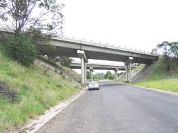
Adoor
Railway overpass and the extention of tunnel length had made road transport under the bridge and pedestrian crossing very difficult
The road to parumala from chengannur passes via perissery which had rail road crossing . This passage of road is always filled with water as the road level below the tunnel is lower than road surface making water to collect in corner making pedestrain passing under the bridge very difficult today and for longer time .
kindly take steps and not to ignore this railway crossing , you can see water collected near the bike also to this end or the mouth of the bridge , the department can widen the passage like shown in the other figure in future as lot of vehicles are going to parmula by this roads


Around kotttayam town in 10 Mns , not more than that . Is this possible now , no , this can be possible if roads are extended and connected to form Ring roads and by passs

Drawn Map sketches from the data collected from different sources


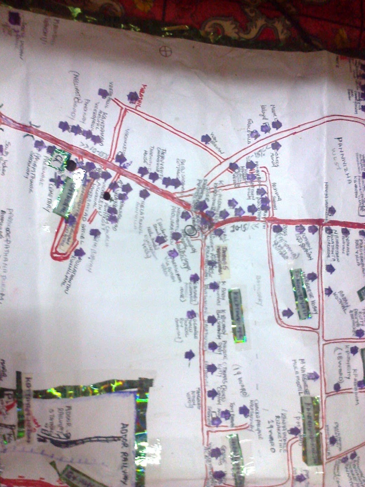


Kerala tourist map with tourist location


New by pass connection


Adoor Kerala
The 1.jpg and 2.jpg shows that the two highway junction in Adoor town and the red line shows the extention of the by pass road on the outer boundary of the town to be constructed .
the 3,jpg is the ketharnath road on landslide , and the reconstruction work by the aerial maps from google digitized by lines
The files are submitted for the GIS developer job for digitization
Yours Sincerly
Georgie S Cherian
Karimpanoor house , pannivizha , adoor , kerala india 691523
Phone 04734224190
09847015595 , 08129709770
No comments:
Post a Comment